Athwatoo Kashmir Travel Guide: Streams, Pine Forests & the Wular Lake Circuit
Athwatoo Kashmir Travel Guide: Streams, Pine Forests & the Wular Lake Circuit
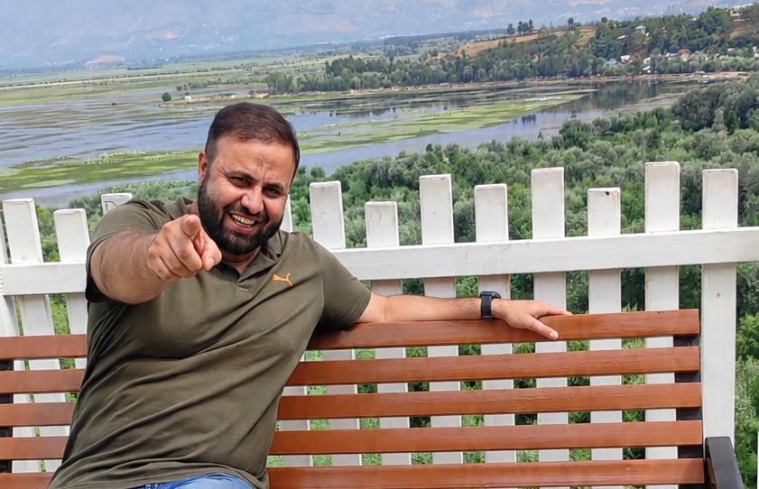
Bandipora's relationship with water shapes almost everything about travelling through it. The town sits on the shore of a lake large enough to be called one of the biggest freshwater bodies in the region, fed by a river that runs full through summer, and the roads leading out of it follow water before they follow anything else along the lake edge, beside the river, and finally up a narrowing mountain road that tracks a stream most of the way to Athwatoo.
Athwatoo itself isn't built around one famous sight it's a forested stretch of high ground above Bandipora where the road ends in a scatter of villages, a government guest house, and a stream running down through pine forest the kind of place that rewards a traveller willing to slow down rather than one looking for a single defining monument.
Understanding the journey there, and what the place actually offers once you arrive, matters more here than at almost any other North Kashmir destination.
Where Is Athwatoo in Kashmir?
Athwatoo sits in the north-eastern part of Bandipora district, in the hills above the town, at an elevation of over 1,600 metres. It's reached by road from Bandipora itself, climbing gradually from the lake-level town into forested, higher terrain.
Officially, the nearest airport is Srinagar, roughly 75 kilometres away, and the nearest railway station is Sopore, around 45 kilometres figures worth treating as approximate route distances rather than precise door-to-door measurements.
The road narrows noticeably on the final approach, particularly towards the Government Guest House, which sits at the practical end of the drivable route. This isn't a dangerous stretch so much as a genuinely narrow mountain road worth knowing in advance so it doesn't come as a surprise, and worth driving at a measured pace rather than treating it like the wider roads lower down.
What Makes Athwatoo Different?
Athwatoo doesn't have the infrastructure or visitor volume of Kashmir's established hill destinations, and that's really the point of going. The villages along the approach road are themselves part of the experience small hamlets carrying on an ordinary rural rhythm rather than existing around tourism.
By the time the road narrows toward the guest house, you've moved gradually from Bandipora's lake-town bustle into a genuinely quieter mountain environment, without a single dramatic transition point it happens village by village, bend by bend.
What stays with most visitors afterward isn't one specific view but a simple contrast at the stream near the guest house: on one side, small hamlets sit close to the water; on the other, a full stretch of pine forest rises along the opposite slope. That image village life and forest facing each other across moving water is as close as Athwatoo comes to a defining scene.
Wular Lake, Bandipora and the Road Towards Athwatoo
Wular Lake anchors Bandipora both geographically and culturally. It is one of Asia's largest freshwater lakes and one of Kashmir's defining water landscapes.
What's consistent across sources is the lake's size and significance: it varies seasonally between roughly 30 and 189 square kilometres, sits at the foothills of the Harmukh range, and has been recognised since 1990 as a Wetland of International Importance under the Ramsar Convention.
Bandipora is traditionally described through a short phrase: Aab, Ilaam aur Adab - water, knowledge and culture.
It's a fitting description for a town built so completely around its lake, and it works especially well as an introduction to this particular journey, since water is the thread running through the whole route: Wular Lake, feeding into the Madhumati River through the town, and finally the Athwatoo stream higher up in the hills.
The Madhumati itself traces back to high-altitude snowmelt off the Harmukh range, and locally it's known to run at its fullest through June to September the same window that makes this whole journey, lake to river to stream, most worthwhile.
Beyond the town, the road climbs through the villages described above before narrowing on the final stretch into Athwatoo.
The Athwatoo Stream — Where Village and Forest Meet
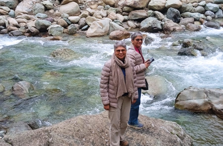
This is Athwatoo's centrepiece, and it's worth treating as more than a stop on a things-to-do list. The stream runs close to the Government Guest House, and the stretch directly alongside it is where most visitors spend their time sitting beside the water, walking the immediate surroundings, taking in the hamlets on one bank and the forest rising on the other.
This section of the stream suits families well; the water here is accessible enough for children to spend time close to it under supervision, without needing to go looking for a specific activity. Further along the stream, there's a deeper section where the water is suitable for swimming and, for strong, experienced swimmers, deep enough in places to dive, when conditions allow.
It's worth being clear that this deeper stretch is a different proposition from the shallow streamside area near the guest house: water depth and current here can vary with season and recent weather, and it should only be approached by capable swimmers, with children kept well away from this particular section and always under close adult supervision at any point along the stream.
Things to Do in Athwatoo
• Sit beside the stream near the Government Guest House and take in the contrast between the hamlets and the pine forest across the water
• Walk the village surroundings and take in the rural character of the approach road and the hamlets themselves
• Spend time in the pine forest on the opposite bank from the main settlements
• Photography particularly the stream, the forest line, and the village-and-forest contrast described above
• Family time at the shallower streamside area near the guest house
• Swimming at the deeper section further along the stream, for capable swimmers only, conditions permitting
• Take in the wider Wular and Bandipora landscape as part of the approach
Best Time to Visit Athwatoo
Based on local experience, June through September is the recommended window. This is when the Athwatoo stream runs fullest, the Madhumati is at its strongest through Bandipora, the surrounding hillsides are fully green, and the wider Wular landscape is at its most attractive.
Weather through this period is generally more favourable for the drive and for time spent outdoors than either the shoulder seasons or winter.
This is a local travel recommendation rather than a fixed or official season Athwatoo can be visited outside this window, but the stream and the surrounding landscape are specifically at their best within it.
How to Reach Athwatoo
The route runs from Srinagar to Bandipora, then up through the villages described earlier toward Athwatoo itself.
The final stretch toward the Government Guest House is where the road narrows most noticeably worth approaching with a vehicle suited to mountain roads and a driver familiar with the route, rather than assuming it handles the same way as the main Bandipora road.
Exact driving times from Srinagar aren't independently confirmed here and are worth checking locally or with a local operator rather than assumed.
Where to Stay for an Athwatoo Trip
There's a Government Guest House at Athwatoo itself, though its current booking process, availability and tourist accessibility are worth confirming directly through official J&K Tourism or local administration channels before relying on it this isn't a commercially booked hotel in the usual sense, and access can depend on official arrangements that are best verified close to your travel dates.
For travellers building Athwatoo into a wider Wular or Gurez journey, Watlab on the shore of Wular Lake is worth considering as an overnight base, letting you spend a night near the lake before continuing up toward Athwatoo and beyond the following day.
Athwatoo Itinerary for a Quiet Escape
Wular / Watlab → Athwatoo → Chandaji Forest Park
For travellers visiting specifically for Athwatoo, without continuing on to a longer Gurez or Lolab trip, a simple route works well: begin around Wular, near Watlab, taking in the lake itself, then continue up through Bandipora and the village road toward Athwatoo.
Spend proper time at the stream and around the villages rather than treating it as a quick stop Chandaji Forest Park, a newly developed forest and eco-restoration site in the Bandipora area, can be considered as an optional extension from here for travellers with the right vehicle and some extra time.
The road toward Chandaji is narrow and genuinely steep in places, and it isn't a drive to take on casually check current road and weather conditions beforehand, and use an appropriate vehicle with an experienced local driver. Treat Chandaji as an optional add-on to the day rather than an essential part of the Athwatoo experience itself.
Athwatoo in a Gurez Itinerary
Athwatoo sits naturally along the broader route toward Gurez, and fits well as a stop within that longer journey: Wular or Watlab as a starting point or overnight base, continuing up to Athwatoo for the stream, village and forest experience described above, before carrying on toward Gurez itself.
It adds a genuinely different, quieter register to a Gurez trip a slower, water-and-forest interlude before the more dramatic high-valley landscape further along the route.
Exact driving times and distances for this combined route aren't independently confirmed here and are worth checking with a local operator when planning.
Athwatoo in a Lolab Valley Itinerary
The same logic applies to a Lolab Valley trip: Wular or Watlab, then Athwatoo, then on to Lolab as part of a broader North Kashmir route.
Athwatoo works well here as a stream-and-forest stop within a longer day or multi-day itinerary through the region's quieter valleys, rather than as a destination requiring its own dedicated trip.
As with the Gurez combination, confirm current distances and road conditions locally rather than assuming a fixed driving time.
Athwatoo vs Gulmarg, Pahalgam, Sonamarg & Gurez
Destination | Character | Landscape | Tourism Footfall | Best For |
Athwatoo | Quiet, village-and-forest | Stream, pine forest, hamlets, high ground above Wular | Low | Travellers wanting a slow, uncommercialised stop |
Gulmarg | Mountain resort | Open alpine bowl and meadow | Very high | Skiing, Gondola, resort-style stays |
Pahalgam | Valley and river | Forested valley along the Lidder | Very high | Slower river-valley stays, families |
Sonamarg | High-mountain corridor | Sharp peaks, Sindh River, glacier terrain | High | Day trips toward Zojila and Thajwas |
Gurez | Remote high valley | Kishanganga River, high border valley | Low- Moderate | Travellers seeking a dramatic, remote valley trip |
This isn't a ranking each of these offers a genuinely different kind of Kashmir trip, and Athwatoo's value lies specifically in being the quietest and least commercialized of the five.
Practical Things to Know Before Visiting Athwatoo
• The approach road narrows considerably towards the Government Guest House drive at a measured pace and use a vehicle suited to mountain roads.
• Water depth and current in the stream's deeper section can vary with season and recent weather treat swimming there as suitable only for capable swimmers.
• Keep children at the shallower streamside area near the guest house, under close supervision at all times.
• June to September is the recommended window for the fullest stream and most favourable weather.
• Confirm current status and booking arrangements for the Government Guest House through official channels before relying on it for accommodation.
• If extending to Chandaji Forest Park, confirm current road and weather conditions and use an experienced local driver — the road is narrow and steep.
• Food availability, network connectivity and other facilities in the immediate Athwatoo area aren't independently confirmed here — check current conditions with a local operator before planning a visit without backup arrangements.
Frequently Asked Questions
Is Athwatoo worth visiting?
Yes, for travellers specifically looking for a quiet, uncommercialised North Kashmir stop its appeal is the combination of village life, stream and pine forest rather than one standout attraction.
Where is Athwatoo in Kashmir?
In the north-eastern part of Bandipora district, in the hills above Bandipora town, at an elevation of over 1,600 metres.
How far is Athwatoo from Srinagar?
The nearest airport is Srinagar, roughly 75 kilometres away by official route distance; exact driving time is best confirmed locally.
What is the best time to visit Athwatoo?
June to September, based on local experience, when the stream and the Madhumati River are at their fullest and the weather is most favourable.
Can families visit Athwatoo?
Yes — the shallower stream area near the Government Guest House suits families and children well, under supervision.
Can you swim in the Athwatoo stream?
Yes, in a deeper section further along the stream, suitable for capable swimmers. Conditions vary with season, and this area isn't recommended for children or inexperienced swimmers.
Is Athwatoo suitable for children?
The streamside area near the guest house is suitable for children under close adult supervision; the deeper swimming section further along is not.
Can Athwatoo be combined with Gurez?
Yes — Athwatoo fits naturally as a stop within a Wular/Watlab to Gurez route.
Can Athwatoo be combined with Lolab Valley?
Yes — it works similarly as a stop within a Wular/Watlab to Lolab Valley route.
Can Chandaji Forest Park be visited from Athwatoo?
Yes, as an optional extension, though the road is narrow and steep and should be approached with an appropriate vehicle and an experienced local driver.
Where should I stay when visiting Athwatoo?
There's a Government Guest House at Athwatoo itself, worth confirming through official channels, or Watlab on Wular Lake as an overnight base for a wider Wular/Gurez journey.
Is Athwatoo suitable as a day trip?
Yes, particularly combined with Wular/Watlab, for travellers not continuing on to Gurez or Lolab — though it also works well as a stop within a longer multi-day route.
Conclusion
Athwatoo isn't a place to visit for one photograph or one named attraction. It's a place to slow down a stream with villages on one bank and pine forest on the other, reached by a road that narrows as the mountains close in, in a part of Bandipora that water has shaped since long before tourism found it.


Comments