Margan Top — The Pass That Has a Valley at Its Summit | Travel Guide 2026 | Tips | Itinerary
Updated: Sep 2
There is a photograph somewhere in my house. I am in it, though I have no memory of being there. My mother and father are on either side of a horse.
They are crossing Margan Top — the pass that connects Kashmir to the twin valleys of Warwan and Marwah.
The year is somewhere in the early 1990s. I am a toddler, presumably on the horse, though I cannot verify this because the photograph does not include me clearly enough to be sure, and my parents' version of events is the only one available.
This guide covers Margan Top in Kashmir — including route, history, Nun Kun viewpoint, Choharnag lakes, and how this pass connects Warwan and Marwah valleys.
What they tell me ,the crossing took hours. The path was narrow ,the horse was steady. The pass was called the Valley of Death not a metaphor, but a description of what happened to travellers who crossed it unprepared, in bad weather, or without knowing the ground.
They crossed it with an infant and arrived on the other side.
I have been crossing Margan Top my entire life. The first time, I was too young to remember. The time that matters, the one I carry was 2006.
Every mountain pass in Kashmir goes up and then comes down. Razdan, Simthan, — you ascend, you cross the ridge, you descend. Margan is the only pass that goes up and then gives you a valley. Eight to ten kilometres of lush alpine ground at the summit. And on the horizon, two of the highest peaks in the western Himalaya — one in Marwah, one in Kargil — visible from the same place at the same time.
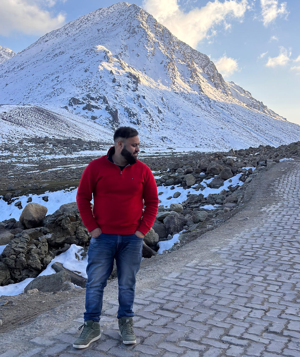
Quick Overview — Margan Top Kashmir
Location: Anantnag to Kishtwar route
Elevation: 12,125 ft (3,696 m)
Best time: May to October
Highlights: 8–10 km alpine plateau, Nun Kun view, Choharnag lakes
Connects: Kashmir Valley → Warwan → Marwah
2006 — My Father, 5 AM, and a Pass Nobody Thought Would Become a Road
I had just passed my 12th exam ,my father had a reason to go to Marwah. We had a day and the willingness to walk.
We reached Gavran at 2 PM — the last village on the Kashmir side before the ascent. There were two other gentlemen with us. The five of us assessed the sky, assessed each other, and started the climb.
Gavran to Nowgan — the first two and a half hours
Two and a half hours of continuous upward movement through forest and open mountain terrain. We reached Navkan at 5 PM.
Mr. Latif ran a small motel there — a Gujar hut converted into shelter for the people of Marwah and Warwan who crossed the pass. We stayed with him ,had dinner and slept.
At 4 AM, my father woke me up. The sky was clear he had been checking it through the night.
4 AM — the ascent to Margan Top
Walking at 5 in the morning on a mountain path above 10,000 feet, in complete darkness. The cold is absolute. The sound is your own breathing and your own footsteps ,you cannot see where the path goes except immediately in front of you, you Just walk.
My father, me, and the two gentlemen. Four hours of continuous ascent from Navkan to the top. No stopping at that altitude in those conditions, momentum is the only sensible strategy.
What I saw when I reached Margan Top
I had crossed Simthan Pass before. I knew what a mountain pass looked like — you climb, you reach a ridge, you see the descent on the other side. The drama is in the crossing then it is over.
Margan Top is not like that when you reach the summit, there is no immediate descent. There is a valley. Eight to ten kilometres of lush alpine meadow, green in a way that is disproportionate to where you are, with streams running through it and the first light of morning arriving from the east across the entire length of it.
And beyond the valley — on the eastern horizon, unmistakable even at that distance — two peaks.
My father pointed Mount Nun & Mount Kun. One in Marwah. One in Kargil. Both visible from exactly where we were standing. I was 18 years old. I had never seen anything like it in my life.
There was no road then. No vehicle had come this way. Choharnag lakes were there, as they have always been, but almost nobody outside the local communities knew they existed. Standing at Margan Top in 2006 with my father, I had no idea that this ground would become a macadamised road, a tourism circuit. I had no idea we would build a travel company that sends guests across this pass. I had no idea I would be writing about it twenty years later.
★ The View That Belongs to Two Worlds — Mount Nun & Mount Kun from Margan Top
There is a viewpoint on the Margan Top plateau — and from it, on a clear day, you can see two of the highest peaks in the western Himalaya simultaneously.
Mount Nun and Mount Kun. The Nun Kun massif: the highest mountains in the Zanskar range, and the highest peaks in Jammu and Kashmir outside of the Karakoram.
Peak | Height | District | Visible from | Character |
Mount Nun | 7,135 m / 23,409 ft | Kishtwar — Marwah side | Margan Top plateau | J&K's highest peak. Southeast horizon from the plateau. |
Mount Kun | 7,077 m / 23,218 ft | Kargil — Ladakh side | Margan Top plateau | Nun's twin. Together they form the Nun Kun massif — the highest in the Zanskar range. |
What makes this viewpoint unlike any other in Kashmir is the geography of what you are seeing. Mount Nun at 7,135 metres sits within the Kishtwar district — its base is in Marwah Valley, the same valley that lies at the foot of this pass.
Mount Kun at 7,077 metres sits across the administrative boundary in Kargil district, Ladakh. Two peaks, two worlds — Marwah and Kargil, Kishtwar and Ladakh — visible from a single position on the Margan plateau.
In most months of the year when the plateau is accessible and the skies are clear, both peaks are visible. In October and November — the best wildlife season in the Kishtwar National Park below — the air is cold enough and dry enough that the Nun Kun massif appears with extraordinary definition.
The Zanskar range extending left and right and in the foreground, the Margan plateau — green, streaming, with Choharnag lakes forty-five minutes to the north.
Standing on Margan Top and seeing Mount Nun in Marwah and Mount Kun in Kargil on the same horizon is the moment you understand the scale of what this pass connects. It is not just Warwan and Marwah behind you and Kashmir in front. It is the entire western Himalayan world, visible in one turn of the head.
Why this matters for photographers and travellers
The Nun Kun massif is one of the most photographed mountain pairs in the Indian Himalaya — from Kargil, from Padum in Zanskar, from the Suru Valley.
Almost nobody has photographed it from the Margan Top plateau, because almost nobody knows you can see it from here.
That is changing .our guests who cross Margan Top on clear mornings now spend time at the plateau specifically for this view.
The combination — alpine meadow at 12,125 feet, Choharnag lakes within walking distance, and the Nun Kun massif on the eastern horizon — makes the Margan plateau one of the finest viewpoints in J&K for anyone who understands what they are looking at.
Mount Nun is J&K's highest peak. Its base is in Marwah Valley. If you want to understand Marwah Valley in its full geographic context — the 57 peaks, the bowl valley, the Kishtwar National Park, the snow leopard wilderness above Fariabad — you need to see Nun from Margan Top. That is where the scale of the place becomes legible.
Tip — Best conditions for the Nun Kun view from Margan Top: clear morning, October to early November. The monsoon haze that reduces visibility in July and August clears completely. Both peaks visible from the plateau with snow on the summits. Arrive at the top before 9 AM before any cloud develops on the lower ridgelines.
What Separates Margan Top From Every Other Pass in Kashmir
Kashmir has many mountain passes. Razdan leads to Gurez , Simthan connects Breng Valley to Kishtwar. Zoji La is the gateway to Ladakh. All follow the same logic: ascend, cross the ridge, descend.
Margan Top does not follow this logic.
Pass | Elevation | What awaits | Valley on descent | Plateau at top |
Margan Top | 12,125 ft | 8–10 km plateau + Nun Kun view + Choharnag lakes | Warwan + Marwah | Yes — unique in J&K |
Razdan Pass (Gurez) | 11,672 ft | Immediate descent | Gurez Valley | No |
Simthan Top | 12,000 ft | Immediate descent | Breng Valley & Chatroo other side | No |
Zoji La | 11,575 ft | Drass / Ladakh | No |
The plateau at the top — 8 to 10 kilometres of alpine valley at the summit, with Nun Kun on the horizon and Choharnag forty-five minutes away — is the geographical fact that separates this pass from everything else.
No other crossing in J&K gives you this. You are at 12,125 feet and you are in a meadow. Both things are true at once.
Looking to Explore Offbeat Kashmir?
Discover lesser-known valleys, villages and landscapes beyond the usual tourist circuit, with private transfers, carefully planned stays and personalised experiences.
Choharnag — The Alpine Lakes Nobody Knew Were There
Forty-five minutes from the top, across open alpine terrain, lie the Choharnag lakes. Chohar (txor) means four Nag means spring or lake.
Four lakes at altitude, the main one large and stone-ringed with water of a specific blue that exists at this elevation and no other.
In 2006, when I crossed Margan Top with my father, Choharnag was not a tourist attraction. Today a guest from England stood at the main lake and said it did not look like a real place — that the photographs looked computer-generated. The lake had not changed. What changed is what the road made visible.

Valley of Death — How a Pass Earned Its Name and Lost It
Margan Top was called the Valley of Death for a reason grounded in meteorology, not melodrama. Weather on the plateau changes in twenty minutes — from clear sky to whiteout, from calm to driving wind.
Communities of Warwan and Marwah crossed it on horseback for centuries to reach the Kashmir Valley with their supplies. Some did not complete the crossing. The ones who did remembered the ones who did not. The name was a warning passed across generations.
The road changed the name more than it changed the pass. The weather on Margan Top is still the same weather. The gradient is the same gradient. What changed is the margin of error.
A vehicle can abort what a horse and rider cannot. But the mountain remembers what it was — and anyone who crosses Margan in uncertain weather with no other vehicles in either direction will understand in their body why it was called what it was called.
From Valley of Death to Tourism Potential — What Changed and What Is Coming
The macadamised road to Margan Top was one of the most consequential infrastructure decisions in J&K tourism.
It did not create something new ,it connected something that already existed — the twin valleys of Warwan and Marwah, the Kishtwar wilderness, the Nun Kun viewpoint — to the rest of the world.
What Margan Top unlocks
• Choharnag lakes — now a full-day excursion from Srinagar. The most accessible alpine lake in Kashmir without multi-day trekking.
• Warwan Valley — accessible to visitors without trekking requirement. Villages, Maru Sudar river, Dul buckwheat, Kayward camping.
• Marwah Valley — J&K's only bowl valley. Kishtwar National Park. Snow leopard wilderness. All via the road across Margan.
• The Nun Kun viewpoint — one of the finest mountain panoramas in J&K. Unknown to most travellers. Forty minutes on the plateau.
• Famber Valley — reached by trek from Marwah , trout, Beem Dalav waterfall. Begins where the Margan road ends.
My father crossed Margan Top on horseback in the 1990s with my mother and an infant who has no memory of it. I crossed it on foot in 2006 at 3 AM, and saw Mount Nun and Mount Kun on the horizon for the first time.
Today I run a travel company that sends guests across it every season. The mountain is the same mountain. What changed is what the world knows is on the other side.
How to Cross Margan Top — Complete Practical Guide
Detail | What you need to know |
Elevation | 3,696 m / 12,125 ft above sea level |
Route from Srinagar | Srinagar → Anantnag → Kokernag → Vailoo → Gavran → Margan Top. ~2–3 hrs by vehicle to Gavran. |
Last village Kashmir side | Gavran — last point before the climb. Navkan is the midpoint rest stop. |
Navkan | Mr. Latif's motel is gone but Gujar huts still offer chai and shelter. Now a selfie stop. Then: 3 AM departure point. |
The plateau | 8–10 km of alpine valley at the summit. Unique in J&K. Nun Kun massif visible on the horizon in most months. |
Nun Kun viewpoint | From the plateau — Mount Nun (Marwah/Kishtwar district) and Mount Kun (Kargil/Ladakh) both visible simultaneously. Two peaks, two world, one horizon. |
Choharnag lakes | 45 min walk from the top. Four alpine lakes. Now a tourist attraction — in 2006 almost unknown. |
Road status | Macadamised. Vehicles reach the top. The horse crossing of the 1990s is history. |
Best season | July–August peak. May–October open. Nun Kun visible in most months when skies are clear. |
What it connects | Kashmir Valley → Warwan Valley → Marwah Valley → Famber Valley trek → Kishtwar National Park. |
The trekking route — for those who want to do it the original way
The road has made the trek optional, not redundant. Crossing Margan Top on foot, with an overnight at Navkan and a 5 AM start, is the original experience.
The cold the dark. The moment the plateau opens. We arrange the full trek version & guide .
Frequently Asked Questions About Margan Top
Q: Can you really see Mount Nun and Mount Kun from Margan Top?
Yes — from the plateau at the summit, on clear days. Mount Nun (7,135 m) sits in the Kishtwar district, its base in Marwah Valley. Mount Kun (7,077 m) sits in Kargil district, Ladakh.
Both are visible on the eastern horizon from the same position on the Margan plateau. Best conditions are October to early November mornings when the atmosphere is clearest. This viewpoint is almost unknown to travellers outside the local communities
.
Q: What makes Margan Top different from other Kashmir passes?
Every other major pass follows the same structure — ascend, cross the ridge, descend. Margan Top has an 8 to 10 kilometre alpine valley at the summit before the descent begins.
Green meadows, running streams, Choharnag lakes forty-five minutes away, and the Nun Kun massif on the horizon. No other pass in J&K combines these features.
Q: Why was Margan Top called the Valley of Death?
The name reflects real danger before road infrastructure existed. The weather changes rapidly and severely at 12,125 feet. Communities of Warwan and Marwah crossed it for centuries on horseback, and some did not complete the crossing.
The name was a generational warning,the road has reduced the physical risk significantly, but the weather on the pass remains the same.
Q: How do I reach Margan Top from Srinagar?
Srinagar → Anantnag → Kokernag → Vailoo → Gavran. By vehicle via the macadamised road, approximately 2 to 3 hours to Gavran, then the drive or trek to the top.
Q: Can I visit Choharnag lakes on the same trip?
Yes — 45 minutes on foot from the top. We include this on every Warwan and Marwah itinerary. Add the Nun Kun viewpoint in the early morning before cloud develops on the lower ridgelines, and the Margan plateau alone becomes a full half-day.
Q: What is beyond Margan Top?
Warwan Valley — one of the most remote valleys in J&K. Then Marwah Valley — J&K's only bowl valley, home to confirmed snow leopards and the Kishtwar High Altitude National Park. The Famber Valley trek begins from Marwah. The entire offbeat Kashmir circuit — Warwan, Marwah, Choharnag, Famber, Kishtwar National Park — is accessible through this one crossing.
Margan Top has more tourism potential than any other pass in Jammu and Kashmir. The road is there. The valleys are there. The Choharnag lakes are there. The Nun Kun viewpoint is there, almost entirely unknown to the tourism industry.
Everything is in place,we have been sending guests across this pass for years. Every trip is different. Every guest who reaches the plateau for the first time has the same expression my father watched me have in 2006. We recognise it immediately. We no longer try to describe it in advance.
We are Tribesmen Travels, Srinagar. Margan Top is the gateway to everything we know — Warwan, Marwah, Choharnag, Famber, Kishtwar. If you want to cross it — by vehicle, by foot, or both — WhatsApp us. We will tell you exactly what to expect. And then the mountain will show you what no description covers.
Cross Margan Top with Tribesmen Travels — WhatsApp: wa.me/916006464123 | +91 600 6464 123


Comments